Most Beautiful Hiking Trails in Málaga
Are you looking to go hiking in Málaga but don’t know where to start? Don’t worry, this article brings you the most beautiful hiking routes in Málaga, a complete list with everything you need to know: the best trails, how to get there and how to hike them, so all you have to do is enjoy! What are you waiting for? Join us as we explore the most magical places in Málaga.
El caminito del rey

The well-known Caminito del Rey, located in the Desfiladero de los Gaitanes near Álora, is famous for its majestic canyon views, which you can admire from its hanging walkways. Although it used to be known as one of the most dangerous paths in the world, after its restoration in 2015 it became a very safe attraction, one that’s worth visiting at least once in your life. Along the route, you can see geological formations, diverse wildlife and panoramic views over the Guadalhorce River. In addition to the Caminito del Rey, in El Chorro you can explore the Guadalhorce reservoir, the Conde del Guadalhorce dam and enjoy activities such as climbing and water sports.
It is easily accessible by car from Málaga via the A-357. There are also trains connecting Málaga with the stations of El Chorro or Ardales, from where shuttle buses take you to the start of the route.
The Caminito del Rey is a linear trail of about 7.7 km that can be completed in approximately 3 to 4 hours. The route includes hanged walkways, tunnels and cliffside paths, with a moderate difficulty level. It’s ideal for people with some hiking experience and good physical condition. The best time to visit it is spring or autumn, when temperatures are milder and there are fewer visitors.
As an exciting new development, the construction of a new 110-meter pedestrian suspension bridge has been announced. It will open at the end of 2025 and will be the longest of its kind in Spain. This structure will be part of an extension of the route, making it even more spectacular and accessible. Without a doubt, this addition will make the Caminito del Rey one of the best hiking routes in the country and a benchmark among hiking trails in Málaga.
- Start: Control point in Ardales
- Difficulty: Moderate
- Distance: 7.7 km
- Type: Linear
El Torcal de Antequera

El Torcal de Antequera is an impressive karst landscape in Málaga, famous for its unique rock formations and accessible hiking trails for all levels. It features several marked routes, such as the 1.5 km Green Route and the 3 km Yellow Route, both easy and well signposted. The Orange Route is slightly longer at 3.7 km, and there is a guided option called the Ammonites Route, rich in fossils and spectacular views. Wildlife and vegetation are diverse, with birds of prey and rare plants. It’s an ideal place for nature lovers and hikers.
- Starting point: Torcal de Antequera Visitor Center
- Distance: 1.5 km (Green Route)
- Difficulty: Easy
- Type: Circular
Chestnut Route (Ruta de la Castaña)
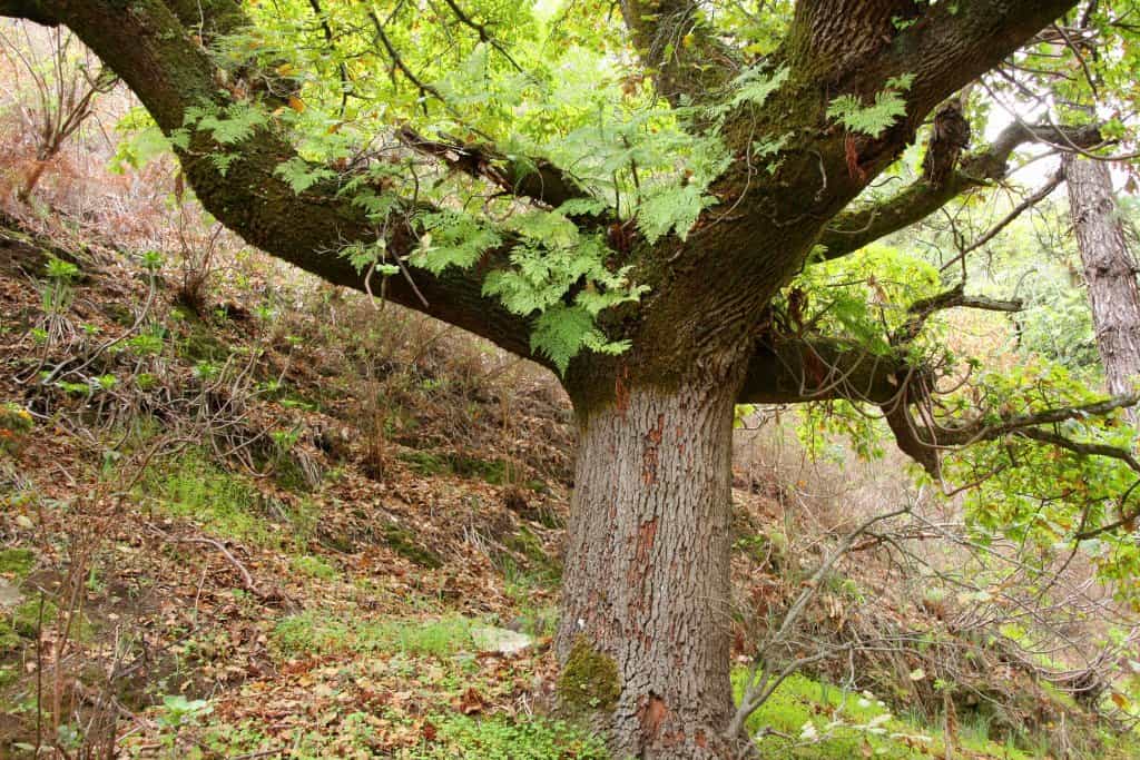
We now head to the Serranía de Ronda, specifically to the Genal Valley, where you’ll find the Chestnut Route. Many consider this route a magical spot, as in autumn the forest turns shades of brown and red, and chestnuts fall everywhere.
The trail is an 8 km low difficulty circular route, perfect for the whole family. It takes around 3 hours to complete depending on your pace and stops. The best scenery and the greatest number of chestnuts can be enjoyed in autumn.
To start this route, head to the village of Igualeja. The trail begins there and continues to Parauta before returning to Igualeja through a different path. Along the way, you’ll find markings from the GR route (Gran Senda de Málaga).
- Start: Igualeja
- Difficulty: Low
- Distance: 8–9 km
- Type: Linear
Pinsapo Route (Ruta del Pinsapo)

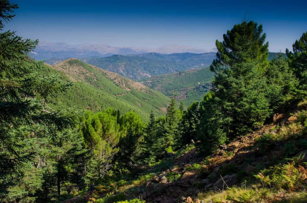
The next beautiful hiking trail in Málaga is the Pinsapo Route in Grazalema. It lies in the heart of the Sierra de las Nieves, just outside Yunquera. This path takes you among Spanish firs and gall oaks in a cool, vibrant natural setting. It begins at the Mirador Luis Ceballos, from where other marked trails also start. It’s perfect for a day surrounded by nature and fresh air.
This 12-km route takes approximately 4 to 5 hours and includes a moderate ascent. Be aware of the fog, which can appear quickly and cause you to lose your way. The best seasons to do this hike are spring and autumn, when the weather is ideal.
- Start: Mirador Luis Ceballos, near Yunquera
- Difficulty: Medium
- Distance: 12 km
- Type: Linear
Chillar River
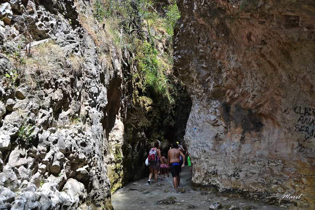
If you’re looking for a refreshing plan in Nerja, the Río Chíllar Route is perfect for the hot months. Walking inside the riverbed, you’ll come across crystal-clear pools and narrow canyons surrounded by nature. It’s a great option to enjoy with family or friends. Remember to wear comfortable, non-slip footwear, as the rocky floor can be slippery.
The route is about 8 km each way (16 km in total) and takes around 6–7 hours. It has low to moderate difficulty, ideal for a long but very entertaining hike.
The trail begins near the parking area on Calle Mirto, Nerja. It is advisable to arrive early to avoid crowds and secure a good parking spot.
- Start: Calle Mirto, Nerja
- Difficulty: Low to moderate
- Distance: 16 km (round trip)
- Type: Linear
Waterfall Trail (Sendero de las Cascadas)
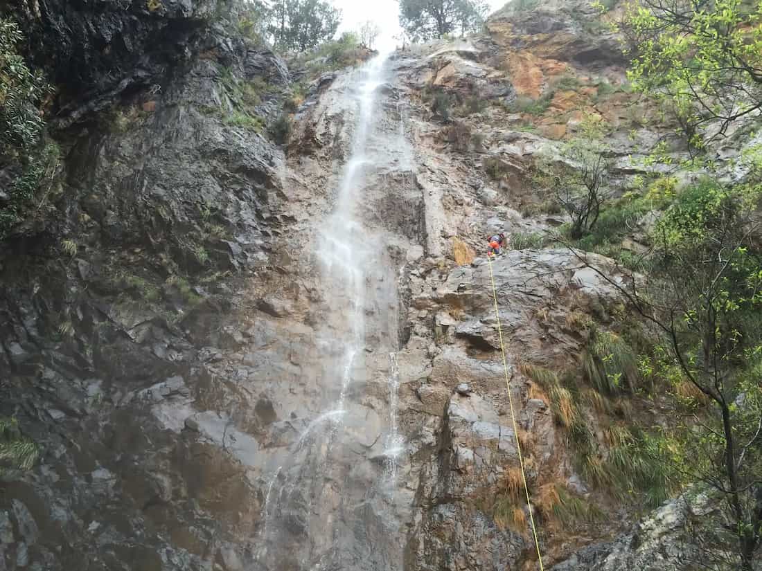
The Waterfall Trail in Tolox is a circular route that takes you past some of the area’s most impressive waterfalls, such as the Salto de la Rejía, the Charco de la Virgen and the Horcajuelos Waterfall. It is an ideal hike after rainfall, when the waterfalls are at their fullest. The route starts at the Balneario de Fuente Amargosa, where you can also enjoy its thermal waters at the end of your hike.
The trail is 11.2 km with a moderate difficulty level, featuring some narrow and slippery stretches, so wear proper footwear and be cautious, especially if you’re going with children. It takes about 4.5 hours to complete.
- Start: Balneario de Fuente Amargosa, Tolox
- Difficulty: Moderate
- Distance: 11.2 km
- Type: Circular
Las Contadoras – Pocopán Viewpoint Route
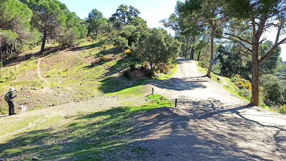
In the Montes de Málaga Natural Park, just outside the city, you’ll find the Las Contadoras Route. This is a circular trail that begins near the “Las Contadoras” Nature Classroom, a building over two centuries old. Along the path, you’ll walk through a reforested pine forest mixed with holm oaks and cork oaks, and if you’re lucky, you might spot squirrels and wild boar at dusk. It’s an ideal route for a family hike, with landscapes that look straight out of a storybook.
The route is 5.4 km long and has low to moderate difficulty, with a total elevation gain of 200 meters. The highest point is the Pocopán Viewpoint at 868 meters, from which you’ll enjoy panoramic views of the Málaga mountains. The last 300 meters to the viewpoint are steep, so take them slowly. It’s best to do this hike in autumn, winter or spring.
To get to the starting point, take the Montes de Málaga road (A-7000) to the Fuente de la Reina, then follow the signs to the “Las Contadoras” Nature Classroom.
- Start: “Las Contadoras” Nature Classroom
- Difficulty: Low to moderate
- Distance: 5.4 km
- Type: Circular
If after discovering some of the most beautiful hiking routes in Málaga you feel like experiencing something even more impressive, we recommend two must-do visits for your getaway. On one hand, explore one of the most surprising karst landscapes in Europe with our guided tour of El Torcal de Antequera. And if you’re looking for a unique adventure among gorges, walkways and breathtaking views, get your official Caminito del Rey tickets here.
And that’s it for this article on the most beautiful hiking routes in Málaga. If you decide to explore any of these trails and want to plan the perfect getaway, visit our website La Garganta. There you’ll find more information about accommodation, activities and services in the area so you can make the most of your nature adventure. See you on the mountains.